DAIMYO'S MAP / Discover the way of Japan
The trip starts
with a detour.
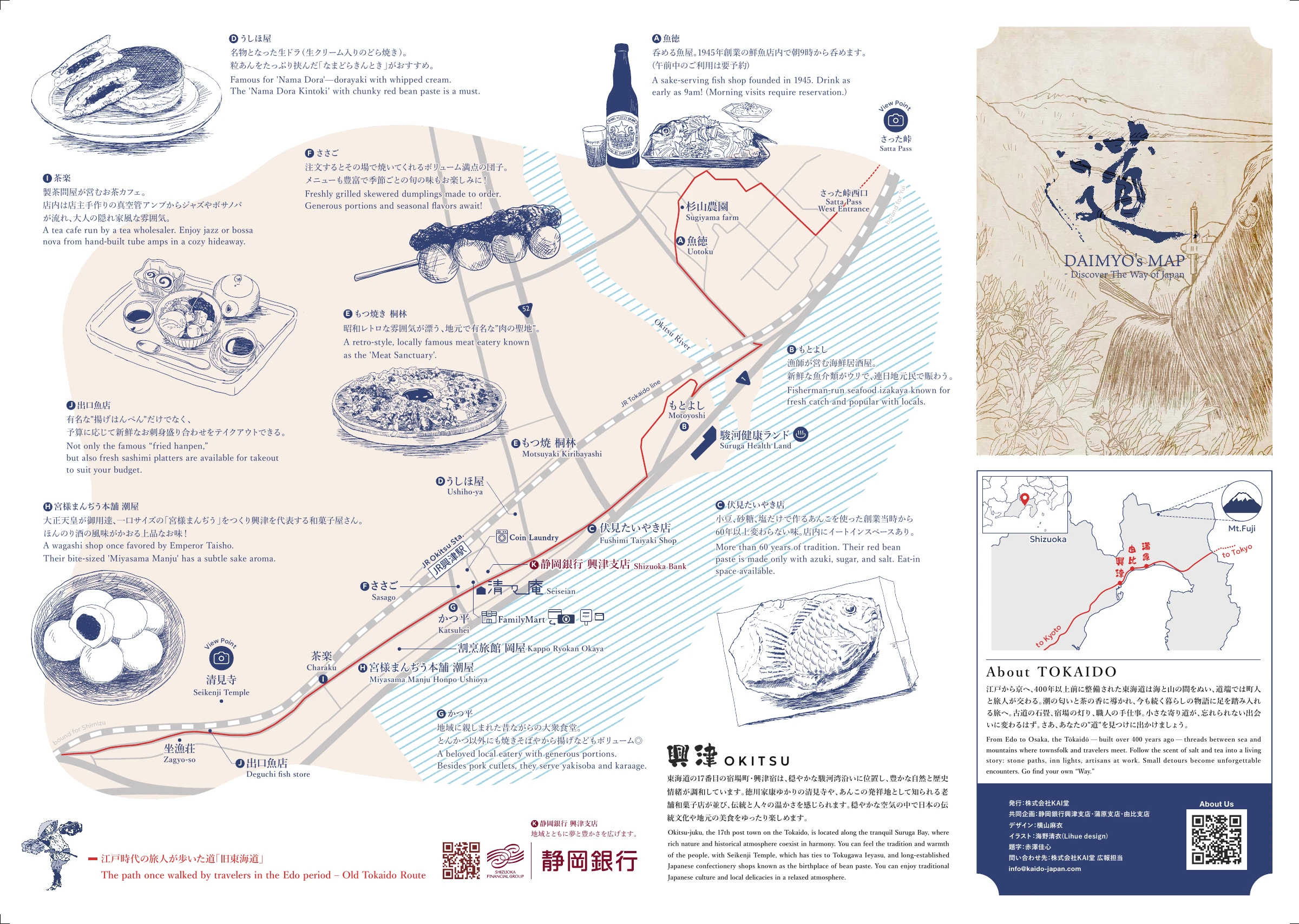
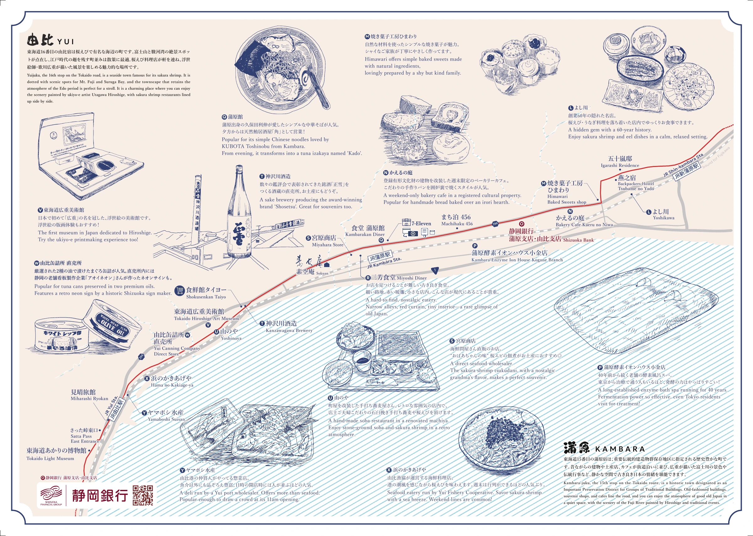
Drink tea. Choose something sweet. Catch your breath in a town diner. This map follows one old road, the Tōkaidō, through the shops and culture of Okitsu, Yui and Kanbara. It is printed in Japanese and English, for planning and for carrying as you walk.
01 / Okitsu
Tea, sweets and a town with history.
Charaku, the sweet shops, Seikenji Temple, Zagyo-so. Start wherever interests you and walk Okitsu from there.
 Enlarge the map
 Select the map to open a larger image. For still larger text, use the PDF.
02 / Yui & Kanbara
Seafood, and life along the old road.
Food and culture in Yui, then the diners and shops of Kanbara. Let the trip spread from one town to the next.
 Enlarge the map
 This is a wide-area walking map. It does not show walking times or recommended cycling routes.
Stay along the way
Beyond a day trip:
a night in one of these towns.
The information is as of when the map was made. Check opening days, hours and what is on offer with each shop or site before you go.
Save the map before you travel.
Japanese and English · 2 pages · PDF 9.4 MB
Published by KAIDO Inc. · In partnership with Shizuoka Bank (Okitsu, Kanbara and Yui branches) · Design: 横山麻衣 · Illustration: 海野清衣 (Lihue design) · Calligraphy: 赤澤佳心